Translate this page:
| Pincode | 123027 |
| Name | Gurha B.O |
| District | Mahendragarh |
| State | Haryana |
| Status | Branch Office(Delivery) |
| Head Office | Narnaul H.O |
| Sub Office | Kanina S.O |
| Location | Gurha Taluk of Mahendragarh District |
| Telephone No | Not Available |
| SPCC | Gurgaon-122001 |
| Department Info | Gurgaon Division Ambala HQ Region Haryana Circle |
| Address | Haryana 123027, India |
| Services | |
| Indian Postal Code System Consists of Six digits. The first to digits represent the state, the second two digits represent the district and the Third two digits represents the Post Office.In this case the first two digits 12 represents the state Haryana, the second two digits 30 represent the district Mahendragarh, and finally 27 represents the Post Office Gurha B.O. Thus the Zip Code of Gurha B.O, Mahendragarh, haryana is 123027 | |
| Pincode | 822118 |
| Name | Gurha B.O |
| District | Palamau |
| State | Jharkhand |
| Status | Branch Office(Delivery) |
| Head Office | Daltonganj H.O |
| Sub Office | Lesliganj S.O |
| Location | Leshliganj Taluk of Palamau District |
| Telephone No | Not Available |
| SPCC | DALTONGANJ-822101 |
| Department Info | Palamau Division Ranchi Region Jharkhand Circle |
| Address | Jharkhand 822118, India |
| Services | |
| Indian Postal Code System Consists of Six digits. The first to digits represent the state, the second two digits represent the district and the Third two digits represents the Post Office.In this case the first two digits 82 represents the state Jharkhand, the second two digits 21 represent the district Palamau, and finally 18 represents the Post Office Gurha B.O. Thus the Zip Code of Gurha B.O, Palamau, jharkhand is 822118 | |
| Pincode | 472221 |
| Name | Gurha B.O |
| District | Tikamgarh |
| State | Madhya Pradesh |
| Status | Branch Office(Delivery) |
| Head Office | Tikamgarh H.O |
| Sub Office | Palera S.O |
| Location | Palera Taluk of Tikamgarh District |
| Telephone No | Not Available |
| SPCC | Tikamgarh-472001 |
| Department Info | Chhatarpur Division Bhopal HQ Region Madhya Pradesh Circle |
| Address | Palera, Madhya Pradesh 472221, India |
| Services | |
| Indian Postal Code System Consists of Six digits. The first to digits represent the state, the second two digits represent the district and the Third two digits represents the Post Office.In this case the first two digits 47 represents the state Madhya Pradesh, the second two digits 22 represent the district Tikamgarh, and finally 21 represents the Post Office Gurha B.O. Thus the Zip Code of Gurha B.O, Tikamgarh, madhya pradesh is 472221 | |
| Pincode | 285122 |
| Name | Gurha B.O |
| District | Jalaun |
| State | Uttar Pradesh |
| Status | Branch Office(Delivery) |
| Head Office | Orai H.O |
| Sub Office | Dakore S.O |
| Location | Orai Taluk of Jalaun District |
| Telephone No | Not Available |
| SPCC | ORAI-285001 |
| Department Info | Jhansi Division Agra Region Uttar Pradesh Circle |
| Address | Uttar Pradesh 285122, India |
| Services | |
| Indian Postal Code System Consists of Six digits. The first to digits represent the state, the second two digits represent the district and the Third two digits represents the Post Office.In this case the first two digits 28 represents the state Uttar Pradesh, the second two digits 51 represent the district Jalaun, and finally 22 represents the Post Office Gurha B.O. Thus the Zip Code of Gurha B.O, Jalaun, uttar pradesh is 285122 | |
| Pincode | 284405 |
| Name | Gurha B.O |
| District | Lalitpur |
| State | Uttar Pradesh |
| Status | Branch Office(Delivery) |
| Head Office | Lalitpur H.O |
| Sub Office | Mahroni S.O |
| Location | Mahroni Taluk of Lalitpur District |
| Telephone No | Not Available |
| SPCC | LALITPUR-284403 |
| Department Info | Jhansi Division Agra Region Uttar Pradesh Circle |
| Address | Mahrauni, Uttar Pradesh 284405, India |
| Services | |
| Indian Postal Code System Consists of Six digits. The first to digits represent the state, the second two digits represent the district and the Third two digits represents the Post Office.In this case the first two digits 28 represents the state Uttar Pradesh, the second two digits 44 represent the district Lalitpur, and finally 05 represents the Post Office Gurha B.O. Thus the Zip Code of Gurha B.O, Lalitpur, uttar pradesh is 284405 | |
| Pincode | 229301 |
| Name | Gurha B.O |
| District | Raebareli |
| State | Uttar Pradesh |
| Status | Branch Office(Delivery) |
| Head Office | Raebarely H.O |
| Sub Office | Bachrawan S.O |
| Location | Mrg Taluk of Raebareli District |
| Telephone No | Not Available |
| SPCC | BCN-229301 |
| Department Info | Rae Bareilly Division Lucknow HQ Region Uttar Pradesh Circle |
| Address | Uttar Pradesh 229301, India |
| Services | |
| Indian Postal Code System Consists of Six digits. The first to digits represent the state, the second two digits represent the district and the Third two digits represents the Post Office.In this case the first two digits 22 represents the state Uttar Pradesh, the second two digits 93 represent the district Raebareli, and finally 01 represents the Post Office Gurha B.O. Thus the Zip Code of Gurha B.O, Raebareli, uttar pradesh is 229301 | |
| Pincode | 283141 |
| Name | Gurha B.O |
| District | Firozabad |
| State | Uttar Pradesh |
| Status | Branch Office(Delivery) |
| Head Office | Firozabad H.O |
| Sub Office | Shikohabad RS S.O |
| Location | Shikohabad Taluk of Firozabad District |
| Telephone No | Not Available |
| SPCC | Firozabad-283203 |
| Department Info | Mainpuri Division Agra Region Uttar Pradesh Circle |
| Address | Uttar Pradesh 283141, India |
| Services | |
| Indian Postal Code System Consists of Six digits. The first to digits represent the state, the second two digits represent the district and the Third two digits represents the Post Office.In this case the first two digits 28 represents the state Uttar Pradesh, the second two digits 31 represent the district Firozabad, and finally 41 represents the Post Office Gurha B.O. Thus the Zip Code of Gurha B.O, Firozabad, uttar pradesh is 283141 | |


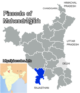
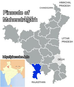
Mahendragarh is a town and a municipal committee in Mahendragarh district in the north Indian state of Haryana. It takes only 2 hours to reach Mahendragarh and is 115.0 KM away from Gurgaon and comes under National Capital Region (India).
Mahendragarh is located at 28.28°N 76.15°E / 28.28; 76.15. It has an average elevation of 262 metres (859 feet). Mahendragarh district is bounded on the north by Bhiwani and Rohtak districts, on the east by Rewari district and Alwar district of Rajasthan, on the south by Alwar, Jaipur and Sikar districts of Rajasthan, and on the west by Sikar and Jhunjhunu districts of Rajasthan. It has 2 tehsils of Narnaul and Mahendergarh.
It is named after Maharaj Mahendra singh who was the ruler during the Mughal era. It is situated at the bank of Dohan rMore Info